
Oak Park ZIP Code Directory Coverage
Michigan's official ZIP map and Oak Park's own city addresses support one standard city ZIP: 48237. The research did not locate an official service-area polygon, a named post-office facility, a PO-box-only designation, a unique-ZIP designation, or a complete neighboring postal-city convention for Oak Park. That is why a full address lookup remains the right way to resolve an individual mailing address instead of extending the city label beyond what the sources show.
| Postal code | Areas covered | Post office | Research note |
|---|---|---|---|
| 48237 | Oak Park, Michigan | Exact facility not identified in the official sources reviewed | Standard city ZIP on the Michigan map and Oak Park city addresses |
A ZIP code directory can state this documented city identity. It cannot fill in unverified boundary lines, delivery classifications, or a list of people receiving mail in the area. Treat any unresolved detail as a reason to use the USPS address form.
Oak Park's 48237 Postal Anchor
The Michigan official ZIP Code Map labels Oak Park 48237. Oak Park's official city, library, and public-safety addresses use the same city, state, and ZIP presentation. That agreement establishes a strong starting point for mail formatting and city identification. It does not turn a postal code into a legal boundary or prove that every nearby address belongs to the city.
For a research note, preserve the full returned address, including directional prefixes, street suffixes, and apartment or suite text. A changed number or different city label can be a sign that the record belongs to another jurisdiction, not a reason to normalize it by guesswork. Use the postal form first, then move to the parcel or historical system that answers the narrower question.
USPS ZIP Code Fields for Oak Park
The USPS ZIP Code Lookup provides three distinct routes. By Address is for a full mailing address. By City and State is for a city-state query. Cities by ZIP starts with the postal code. The documented fields below make it clear why a city-only result is not the same thing as an address validation. Select the route that matches the information actually available, then use Find.
| Lookup route | Field | Requirement | Use in Oak Park research |
|---|---|---|---|
| By Address | Company | Optional | Leave blank when it does not apply. |
| By Address | Street Address, City, State | Required | Validate the full mailing form. |
| By Address | Apt/Suite and ZIP | Optional | Add details already known from the address. |
| By City and State | City and State | Required | Confirm the city-state postal association. |
| Cities by ZIP | ZIP | Required | Check the city name associated with the code. |
The USPS lookup interface is the source for the documented tabs and fields.
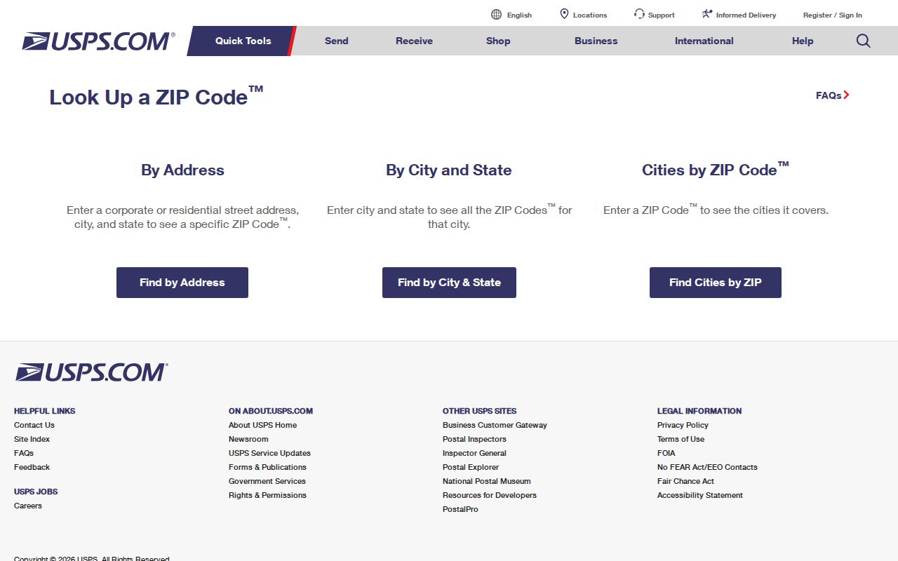
The form is useful for postal validation. Save neither a search result nor a screenshot as a substitute for a parcel, title, or historical directory record.
Use an Oak Park ZIP for Records
The researched channels do not document a ZIP-only people search in the county parcel services or the Michigan voter route. USPS accepts ZIP input for its Cities by ZIP tab, but USPS also warns that the result does not confirm a person or company. The postal result is therefore a first sorting field, not a way to identify who receives mail at an address. When a record question has a lawful personal, family-history, estate, civic, or anti-fraud purpose, continue only with a specific address or parcel identifier.
- Use City and State or Cities by ZIP to check the Oak Park postal association.
- When a street address is known, use the USPS By Address route to confirm its mailing form.
- Keep the returned city, state, ZIP, and any apartment detail with the source date.
- Move the verified address to the county parcel service, not a ZIP-wide name list.
- For a street-level record trail, use the Oak Park street directory lookup after the address has been normalized.
Oak Park BS&A offers address, name, and parcel choices for municipal reference searches, but the research did not identify a ZIP-only field there. The Michigan voter-information and voter-file routes have their own access rules and are not a substitute for an address-level postal check.
Note: A postal result validates mailing information only; it does not establish a relationship between a person and the address.
From Oak Park ZIP to Parcel PIN
After the full address is verified, use Oakland County Property Gateway to resolve the parcel. The county FAQ says a user can search by property address or click a parcel on the map. A valid PIN is the county's unique 10-digit parcel identifier, also called a Parcel Number, Parcel ID, or Sidwell. This is the point where a postal address becomes a county parcel reference, with its own map, assessment, and recorded-land trail.
The county advises keeping the address exactly as returned and recording the PIN, municipality or CVT, and tax or assessment year. If an address search returns more than one parcel, stop and resolve the legal parcel before associating it with a document. The display is current reference data, not a certified assessor record or recorded instrument.
The Property Gateway search provides the address-to-PIN handoff described here.
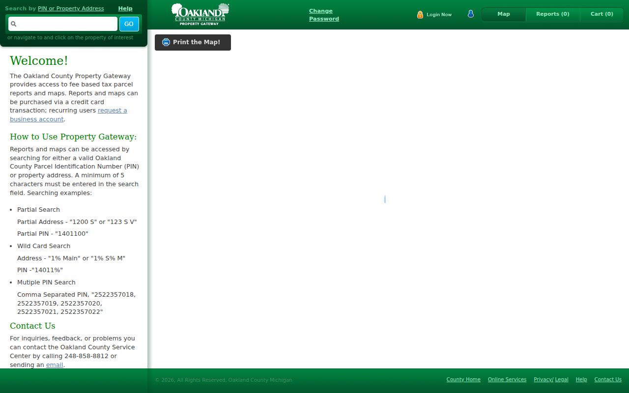
Once the PIN is known, compare the parcel display with Oak Park BS&A and then use the county records custodian for a recorded document. Each source should keep its own date and limitation. For a map or account question, Oakland County mapping services lists Property Gateway support at 248-858-8812 and servicecenter@oakgov.com, as well as custom-map appointments.
Oak Park ZIP Boundaries and City Lines
Postal geography, municipal geography, parcel geometry, and Census geography are different layers. The Michigan map expressly notes that ZIP boundaries do not coincide with Census ZCTA boundaries. An Oak Park postal result is not evidence of the city limit, and neither a ZIP polygon nor a ZCTA should be used to draw a parcel boundary. For city services, check the municipal address and department jurisdiction. For property questions, use the address and PIN.
This distinction is especially important near corridors that continue into nearby places. The research names 8 Mile, 9 Mile, 10 Mile, 11 Mile, Greenfield, Coolidge, Scotia, and Northend as Oak Park-area corridors. A corridor name is not a boundary description. Resolve each full address with USPS and then the county map rather than assigning a city from the road name alone.
Keep the record layer in the research note. The postal result answers a delivery-format question. A city address helps identify municipal jurisdiction. A PIN connects an address to a county parcel, and a historic township label places an older record in time. None of those fields should be substituted for another.
| Postal delivery | Use 48237 and a full address to validate mailing form. USPS says that result does not confirm a person or company. |
|---|---|
| Municipal place | Use the City of Oak Park for department and facility jurisdiction, recognizing that city limits differ from postal ZIP geography. |
| County parcel | Use the 10-digit PIN, Parcel ID, or Sidwell for the property map, assessment reference, and deed trail. |
| Census geography | Use a ZCTA or enumeration district for historical or statistical context, not as a USPS boundary. |
| Historical jurisdiction | Use Royal Oak Township or Oak Park exactly as the dated record prints it, then support any bridge with a source. |
- ZIP and ZIP+4
- A ZIP identifies a postal delivery area. A ZIP+4 adds a narrower delivery segment; neither one is a parcel number.
- PO-box ZIP
- A postal code assigned for post-office boxes. The research did not confirm a PO-box-only ZIP for Oak Park.
- Unique ZIP
- A postal code assigned to one organization or facility. The research did not confirm one for Oak Park.
- Carrier route
- A postal delivery grouping used for mail handling. It is not a municipal boundary or proof of a named recipient.
- ZCTA
- A Census statistical area that can resemble a ZIP but does not share the same boundary rules.
Oak Park Records Change at 1945
A historical mailing or directory entry may use Royal Oak Township before Oak Park's 1945 city transition. That label shift is separate from both the modern ZIP and the parcel map. When an older source does not say Oak Park, preserve the printed jurisdiction and test it with a dated map, directory, deed, or charter source. The year is part of the address evidence.
For a historical household listing, use the Oak Park city-directory collections route and pair the directory year with a census or archival source. The postal code should not be projected backward onto an earlier township record.
Oak Park ZIP Research Gaps
The official sources reviewed support 48237 and the USPS resolution path, but they do not provide every detail a reader might want. Exact service-area lines, PO-box status, unique-ZIP status, and every neighboring postal-city convention were not located. The responsible response to that gap is a full-address USPS lookup, not a guessed coverage map or a generalized list.
For a reproducible note, record the source URL, date checked, full normalized address, ZIP result, PIN if one is needed, and the record type being consulted next. That record sequence respects the difference between delivery information, city jurisdiction, county parcels, and historical labels.